embedded image into the answer
Source Link
Roger Attrill
  • 71.3k
  • 15
  • 154
  • 248

https://i.sstatic.net/FpWf2.jpg

Check above link.

just Just tried to improve the concept taken from above designs. 

I tried to group functionality that works together. 

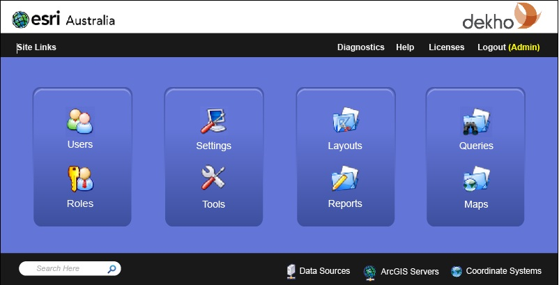
Data sources | Arcgis server | coordinate systems describe connections to external systems. 

Queries and Maps (i guess the mostly used functions) have moved to right hand corner where users will find it more easy to locate. 

Product logo is prominent at the top right corner against the company logo.
enter image description here

https://i.sstatic.net/FpWf2.jpg

Check above link.

just tried to improve the concept taken from above designs. I tried to group functionality that works together. Data sources | Arcgis server | coordinate systems describe connections to external systems. Queries and Maps (i guess the mostly used functions) have moved to right hand corner where users will find it more easy to locate. Product logo is prominent at the top right corner against the company logo.

Just tried to improve the concept taken from above designs. 

I tried to group functionality that works together. 

Data sources | Arcgis server | coordinate systems describe connections to external systems. 

Queries and Maps (i guess the mostly used functions) have moved to right hand corner where users will find it more easy to locate. 

Product logo is prominent at the top right corner against the company logo.

enter image description here

Source Link
Gyni
  • 111
  • 2

https://i.sstatic.net/FpWf2.jpg

Check above link.

just tried to improve the concept taken from above designs. I tried to group functionality that works together. Data sources | Arcgis server | coordinate systems describe connections to external systems. Queries and Maps (i guess the mostly used functions) have moved to right hand corner where users will find it more easy to locate. Product logo is prominent at the top right corner against the company logo.